|
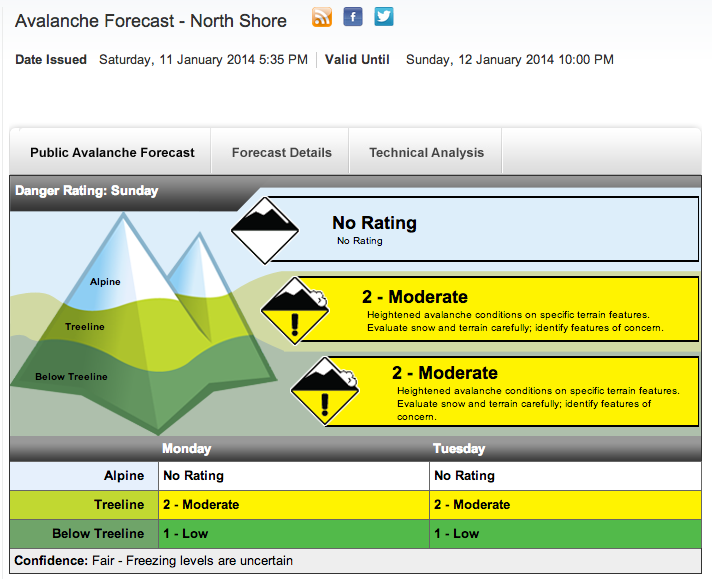
Words by: Brent Hillier Photos by: Brent Hillier, Norma Ibarra & Tim Gage When I first started my career in the Avalanche Industry my mandate was to use every opportunity as a learning experience. While patrolling on Mount Seymour, I would create my own avalanche bulletin the night before my shift. During my day on the mountain I would prove or disprove my predictions on what the snowpack would do and what the CAC Bulletin might say. Only after I had gathered all of my own beta and made my own stability assessments, would I review the days CAC Bulletin and critique my accuracy.
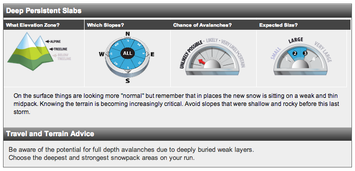
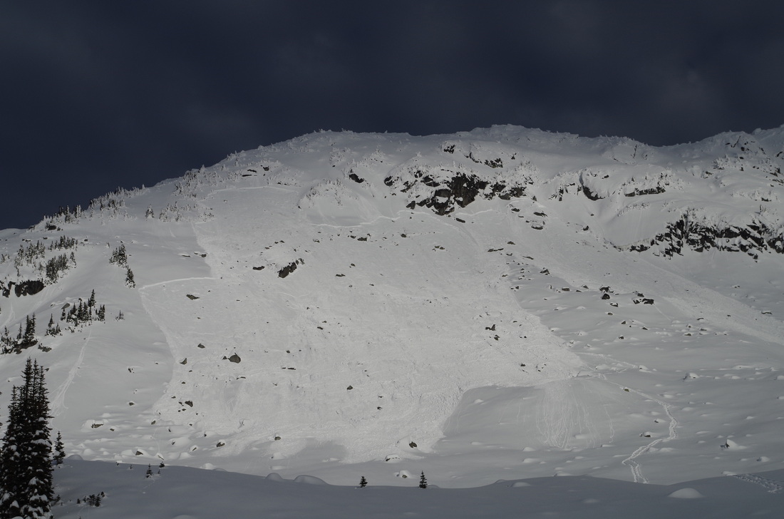
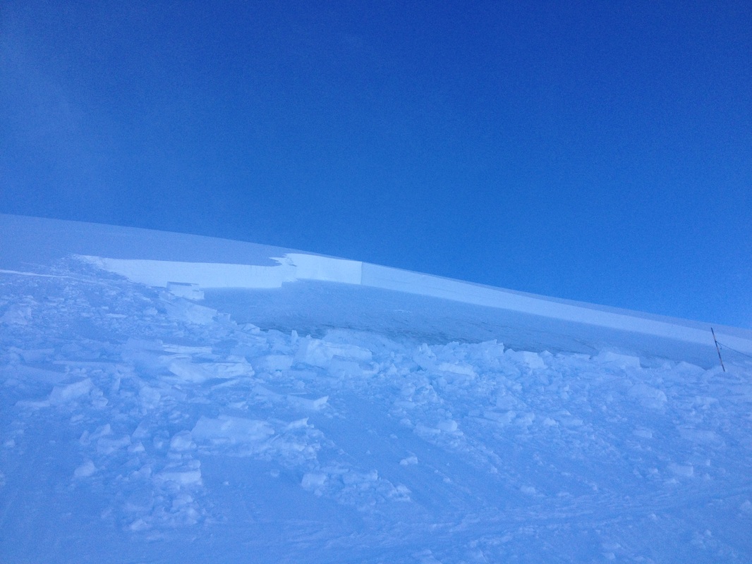
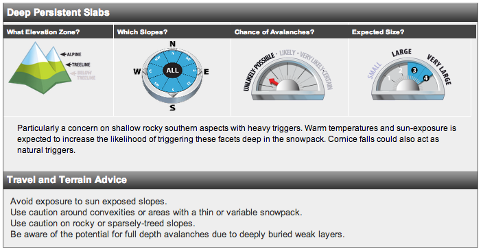
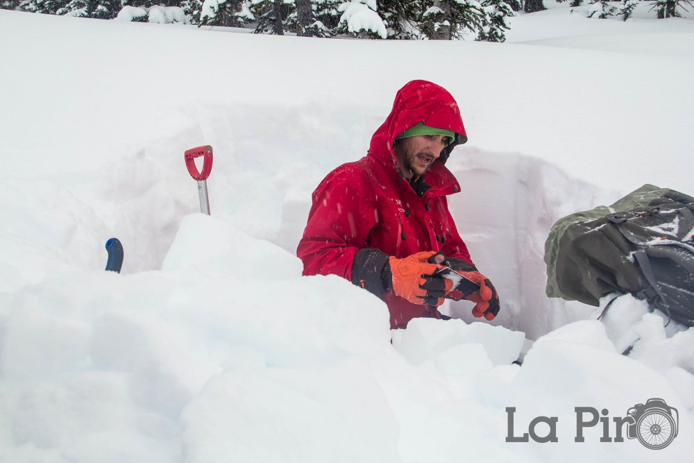
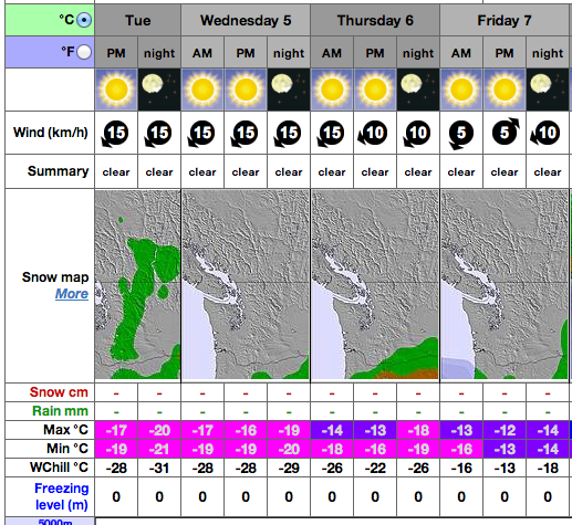
This year's biggest snowpack concern on the Coast has been a Persistent Weak Layer (PWL) that has already produced some very large avalanches. Generally, here on the coast, we have a snowpack that is always trending towards stable. We've developed the mantra "Two Days to Moderate", meaning that any storm slab instabilities will stabilize after a couple of days. If skiers and boarders wait a day or two after a storm then the danger rating is moderate and the stability is relatively good. This is because our average snowpack is quite deep and our air temperatures are on the warmer part of the thermometer. These factors favour the snow metamorphism known as rounding, rounds are stable and mean a well bonded snowpack. With our 60 to 80cm snowpack in mid-december and air temperatures at the peak of Whistler sitting at -19°C the opposite happened. Facetted crystals are sugar like and do not bond well with each other. These crystals are more common in the Rockies, where the snowpack is shallow and the temperatures are cold, but they are not something we often see here on the coast. With this irregularity the Canadian Avalanche Centre, on January 10th, gave warning and posted on the Forecaster's Blog: Attention Sea-to-Sky Shredders. For more details on Persistent Slab Avalanches the Utah Avalanche Center posted the below video. As this PWL began to get buried more and more it became harder and harder to trigger. Although more snow decreases the probability it increase the consequences and we're left with one of the most unpredictable snowpack problems out there, Low Probability / High Consequence (LPHC). It's circumstances like this that has seen some of Canada's worst recreational avalanche tragedies, including the event in Roger's Pass on February 1, 2003 that claimed the lives of seven teenagers on a school trip. That particular day the hazard rating was just Moderate, but even in moderate the Avalanche Danger Scale states that "large avalanches in isolated areas" are possible. Persistent Weak Layers are often described as lurking within the snowpack, like a monster that could strike at anytime. One of my AST students from this past weekend shared an incident he was involved in on January 5th in the Duffy Lake area. He and his partner had remotely triggered a Size 2. The failure layer was our lurking PWL of facets sitting on the late November crust. The two snowshoers who triggered this avalanche were at the bottom right-hand of the slide. Triggering an avalanche when not in the start zone is referred to as remote trigger. When their is a possibility of remotely triggering a weak layer it means that, not only is that layer sensitive, but that the failure in shear has the potential to propagate through-out the snowpack and across the mountain. Turning an instability into a big problem. With reports like the one above, our concerns are proven to be real. As this layer gets buried, our concerns should still be there, but the warning signs become fewer and our confidence begins to grow. The key is to look to the Bulletin, particularly the Avalanche Summary section. We now fast forward to January 17th, I snapped the below photo while skiing on the Blackcomb glacier. The avalanche released on a basal facet layer, the same lurking PWL we've been watching all season. The crown line at the top was measured to be 2m in height and the avalanche rated as a Size 2.5 to 3. Once again our concern is proven valid, this time the trigger was sympathetic through explosive control, meaning while ski patrol was heli-bombing an adjacent slope this avalanche ripped out. Once again proving that this layer is not only there, but producing and has the potential to propagate. Our next major weather event came at the end of January as a major inversion and rapid warming in the alpine. With overnight temperatures reported to be at +8°C in the alpine our upper snowpack begin to get heavy and unconsolidated. This was the next real test of our lurking PWL. On a trip to the Keith's Hut on January 29th & 30th I wanted to see if these warm temperatures would help stabilize the basal facet layers. I dug down 2m and proceeded to do a number of Deep Tap Tests and I continued to get Sudden Planer results. Our PWL was still there, and it was still producing results. With cold temperatures returning to the Coast we've developed a variable melt-freeze crust on the surface. All of the wet-loose snow from the temperature inversion has re-frozen. Although this makes for horrible skiing throughout the sea-to-sky corridor, it has potentially bridged any instabilities at the bottom of our snowpack. The concept of bridging is when the snowpack is capped with a crust, in this case a melt-freeze crust, that crust prevents us from properly affecting anything below it. That said, spatial variability existence in the mountains, and the crust we're relying on right now to keep us safe and in our current low avalanche hazard may not exist everywhere. Read more about bridging in Scott Thumlert and Bruce Jamieson's paper: Bridge Over Troubled Facets. So now our current weather is cold, irregularly cold. So what's my prediction as to how this will effect our snowpack? Well, if temperatures prove to be as cold as what is predicted, upwards of -20°C, then our melt-freeze crust could begin to facet. Not only could this mean it's bridging properties will disappear but we could have another weak layer develop once it gets buried.
Will I be right? Who knows! But one thing is for sure, whatever does happen, I'll be taking it as a huge opportunity to gain more knowledge about snow.
0 Comments
Leave a Reply. |
Brent HillierStories, Pictures and Video of all my adventures, on skis and bike. Archives
April 2020
Categories
All
|

 RSS Feed
